Flood Season is Coming, Schedule a Flight with Our Aerial Mapping Team

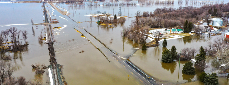
Spring is right around the corner, which for some of us, means flood season. High resolution aerial photography and precise lidar data can help you better understand areas of concern. This information can be used to determine what improvements could be done to help alleviate future problems.
Benefits of capturing aerial data during high water levels.
- Historical data – can be used to compare past high water levels/changes in topography, or provide data to be used in the future.
- Aerial views – can illustrate potential issues and solutions that can take place before issues become major problems.
- Data – provides information for documentation and justification to be used for funding agency applications in case funding assistance is necessary.
Schedule a flight with us today to reserve your spot on our spring project list.

Miles Strain, CP, RPP, VP
/ About Author
Miles is the aerial services manager in Widseth's Grand Forks office. Contact him today to discuss your next project. Miles.Strain@Widseth.com or 701-738-8486.
Search Archives
Categories
Posts by Topic
- Staff News (98)
- Architecture (66)
- Funding (61)
- Civil Engineering (53)
- Education (48)
- Architectural Design (38)
- Engineering (37)
- Land Surveying (32)
- Surveying (26)
- Environmental (22)
- Commercial (21)
- Interior Design (18)
- Streets & Highways (17)
- Utilities (17)
- Water Resources Engineering (14)
- Industrial (13)
- Community (11)
- Cultural (11)
- Landscape Architecture (11)
- Sports & Recreation (11)
- Government (10)
- Aerial Mapping (8)
- Mechanical Engineering (8)
- GIS (7)
- Electrical Engineering (6)
- Structural Engineering (6)
- Senior Living (5)
- Transportation Engineering (5)
- Bridges (3)
- Site Design (3)
- Transmission & Distribution (3)
- Healthcare (2)
- Planning (2)
- manufacturing (1)
Recent Posts
-
May 06, 2024


